Wireless sensors and Yggio, the open operational layer for cities, property owners and transport operators. Your data, your operations, your sovereignty.

For street and stormwater departments

Empty the wells that need it.
Know which ones they are.

A radar sensor in selected wells, a QR code in every well for the sludge truck to check in, and the level history that shows how each well behaves in rain and after emptying. The schedule follows the wells, not the calendar.

The problem today

Every well on the same schedule, whatever is in it

Street wells and storm drains are emptied on a cycle, because nobody knows what is in them:
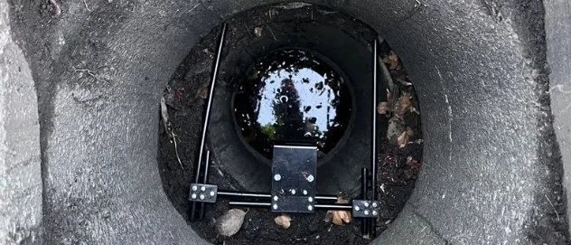
  • The sludge truck visits every well on the list, including the ones that were still half empty, and misses the ones that filled up in a month.
  • At a cloudburst the clogged wells show themselves as water on the street, and the calls come in before the crew knows where to go.
  • A well that drains slowly after rain, because its outlet is blocked, looks exactly like a working well from above.
  • Whether a well was emptied, and when, lives on a paper list or in the driver's memory, not with the well.
Looking down into a storm drain: a Puck Radar on a bracket above the water, with leaves on the sand trap

Measured wells, checked-in visits, and the function of every well

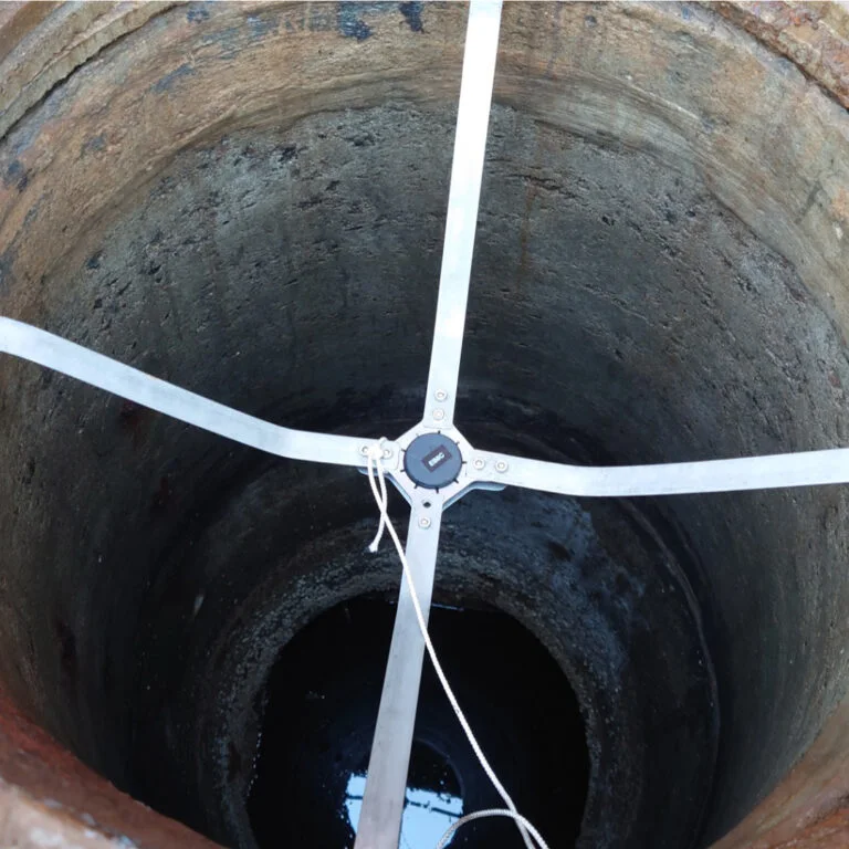
A Puck Radar sensor on a cross-shaped bracket inside a well, looking down at the water

Measured, not guessed

Puck Radar sits on a bracket in selected wells and reports the distance to the water surface over LoRaWAN, at the interval you set. A radar does not mind dirt, darkness or damp, and the battery lasts well over ten years.
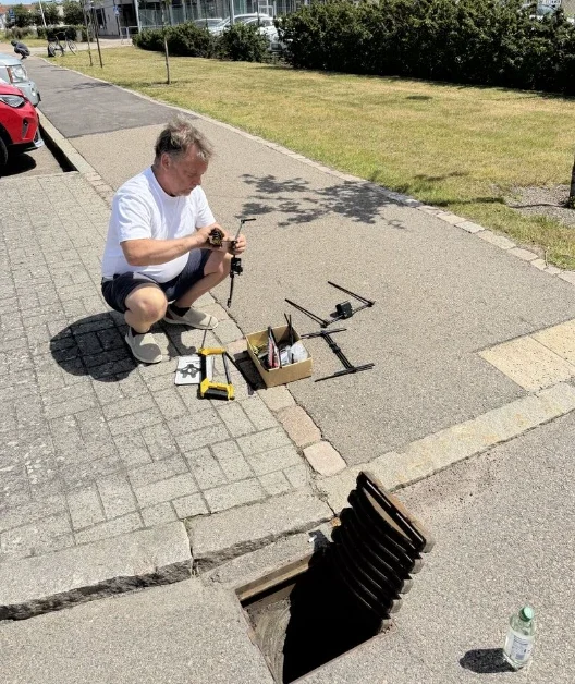
An installer kneeling on the pavement beside an open storm drain, preparing a Puck Radar and its bracket

Every well accounted for

A QR code inside every well lid. When the sludge truck has emptied a well, the crew scans it and the visit is recorded on that well in Yggio, with the time. Wells without a sensor get a maintenance history too.
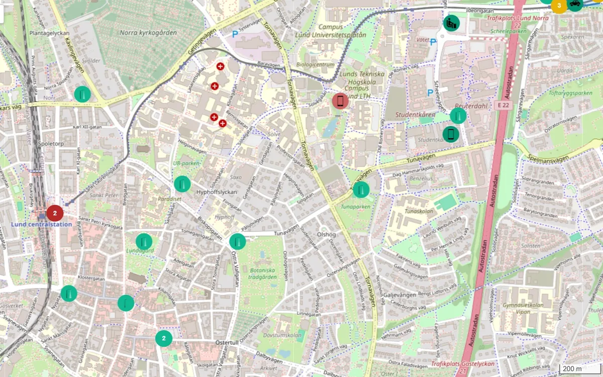
The Yggio map of a city with devices across the streets, coloured by signal strength

The function, not just the level

How fast a well fills in rain, how fast it drains afterwards, and how the level falls when it has been emptied: Yggio keeps the curves per well, so the department sees which wells silt up fast, which outlets are blocked, and which wells never needed the visit.

A rainy night, a truck and a month of data

Ordinary moments on the street, each one answered with a measurement.
A storm drain seen from above, with a Puck Radar on its bracket above the water
Level high in rain · Well 14, StorgatanText to the duty officer · 02:10
Actions in the Yggio rule engine: send email, send SMS and send HTTP

A cloudburst, and well 14 fills faster than its neighbours

The level rises in every measured well along Storgatan, but well 14 rises faster and stays high when the others fall. A rule in Yggio raises it as an alarm with its place on the map. When the crew starts at seven, the first address is already decided.

An installer beside an open storm drain on a street, with the sensor bracket laid out on the pavement
Emptied, checked in · Well 14Sludge truck 2 · 09:32
The Yggio map of a city with devices across the streets

The sludge truck checks in

The crew empties well 14 and scans the QR code inside the lid. The visit is recorded on that well, with the time, and the level afterwards shows the well draining as it should. No list to fill in, and no doubt later about which wells were done.
A Puck Radar on a bracket inside a well, with the water surface below
Drains slowly after rain · Well 7Outlet to be checked · 14:05
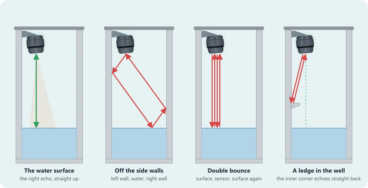
How the radar reads a well: the right echo straight down to the water surface, and the echoes off the walls, a double bounce and a ledge that the sensor is set to ignore

Which wells need the truck, and which do not

The curves from the rainy weeks and the visits tell the department how each well behaves: three wells silt up within weeks, one drains slowly after every rain and needs its outlet cleared, and most of the measured wells did not need the visit at all. The next schedule is written from that, well by well.

More on City, Puck Radar, Traffic signals and street lighting

Pilot

A pilot in Helsingborg’s storm drains

In a pilot in Helsingborg, Puck Radar sits in storm drains and measures the water level, so the city can see how its wells behave in rain and plan their maintenance. The measuring method for wells, with exclusion zones for ledges and fittings, comes from that work. Bring your own well register and the last year’s sludge-suction schedule, and we work out together how many measured wells it takes to plan the rest.

Pilot: twenty wells through one rainy season

Four steps, from your well register to the next schedule.

  1. Choose the wells: the ones that flood, the ones that always seem full, and a few that never cause trouble, so the data has something to compare.

  2. Install: a Puck Radar on a bracket in each chosen well, a QR code inside every lid in the district, and the wells on the Yggio map with the sludge-suction rounds as they are today.

  3. The rules in Yggio: a level alarm in rain, a slow-drain warning after rain, and the check-in from the QR code recorded on each well.

  4. After the season: the curves per well, the visits that were needed and the ones that were not, and a schedule written from them.

Book a demo or ask about the pilot

Tell us how many wells you look after, how often they are emptied today, and where the water stood last time it rained hard.

Or write to sales@sensative.com

Technical details

For IT, procurement and integrators.

Puck Radar in a well
  • 60 GHz radar, measuring range 0.2–7 m with 1 mm resolution and accuracy. The well measuring method reads the distance to the water surface; two measuring zones and up to two exclusion zones mask echoes from ledges, fittings and walls.
  • Mounted on a cross-shaped bracket that braces against the well wall, above the highest expected water level. Brackets for wells are sold separately.
  • IP67, well over ten years on the battery, a 3D accelerometer that reports movement and tilt if the sensor has been knocked, and temperature and humidity on board.
Radio and configuration
  • LoRaWAN for the readings, so the city's own network or a network as a service carries them; a radio in a well below street level is tested in the pilot before the roll-out.
  • Set up on site with the Hugin app over NFC for the LoRaWAN board, and SweIoT Toolbox for Puck & Prism radar sensor over Bluetooth for the radar board, including a scan that shows where the echoes come from.
In Yggio
  • Every well is a device on the map with its level history; the QR check-in is recorded on the same well, so visits and levels sit together.
  • The rule engine raises the alarms and warnings, and sends them by email, text or to another system over HTTP.
  • The stormwater department owns its data in its own Yggio account and shares the dashboards it chooses with the street department, the contractor or the city's other administrations.
Integration and procurement
  • One open API and one common data model for everything in Yggio, so the well data can go to the city's own systems or a data marketplace listing.
  • Yggio runs as a service, on the city's own servers or at the edge; the data stays where the city decides.

Related solutions: City, Traffic signals and street lighting, Data marketplace